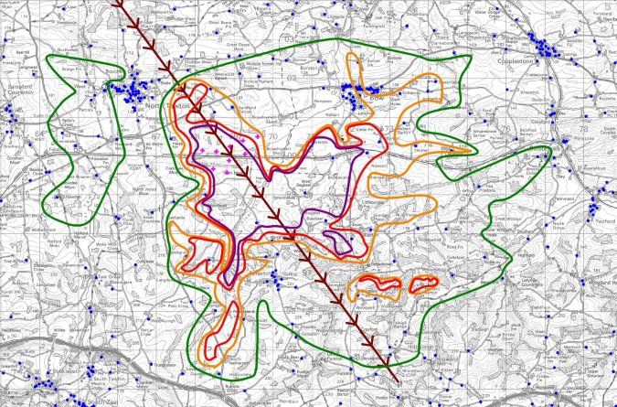
The impact modelling takes into account; the number of turbines, the heights of the towers and the rotor diameters; the radar cross sectional area of the turbine blades; the transmission path from the television transmitter to the wind farm site and beyond; digital terrain modelling; the transmit antenna patterns and effective radiated powers (ERPs); receiver antenna discrimination and performance; and free space radio path loss.

The produced technical report can be used to support a planning application, to discharge an associated planning condition, or for the inclusion in a EIA submission. If specified in the planning condition, the report would also detail the baseline television / radio reception data (from a signal survey) to assist in the identification of the source of any future interference. The impact modelling can be presented in a GIS / mappable format (MapInfo TAB files) and will indicate areas of interference severity and also postcode data to assist project managers understand how many potentially affected households exist, where they are located and overall mitigation costs.

The issued report would include mapping and data licensed from Ordnance Survey (OS) under the terms of the Open Government Licence; OS data Crown copyright and database copyright (2023).

Contact us on 01926 744771 to discuss your requirements
